
LANDMARKS
Rock Monasteries
Mysterious and marvelous, the rock monasteries in Shumen are among the few surviving architectural monuments of our medieval history, living testimonies of the power of the Bulgarian spirit. Situated in beautiful natural areas cut into almost unreachable rocks and rock wreaths, for centuries they sheltered the monks of hermits. The monks spent their lives in silence, solitude and prayer in the name of their unity with God. The rock monasteries arise in the years of the Second Bulgarian Kingdom and are most often a complex of churches, monastic cells and tombs.
KALUGER BOAZ
Kalugerka Cave, famous among the local population, such as the Han Krumovski Rock Monastery. Built in a cave and a rough-edged tool that left visible traces on the walls. To the entrance of the monastery is reached, by steps cut into the rock. It has three compartments, the eastern one used for church.
The cell is set on the eastern slope of the Cortuluka River, opposite the Kaluger Cave, with an interesting inner archeology. The entrance represents a rock crevice, and inside there is a large rock mass with smooth walls - a column that divides the space into several compartments.
TROISHKI BOAZ
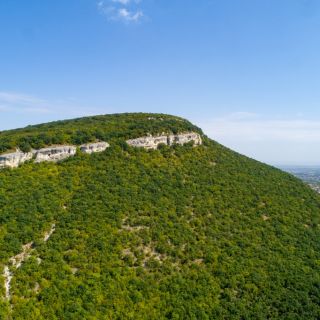
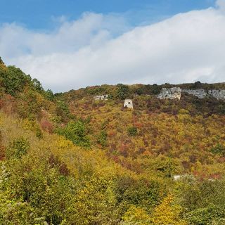
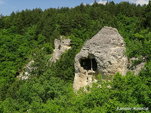
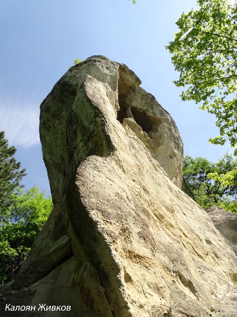
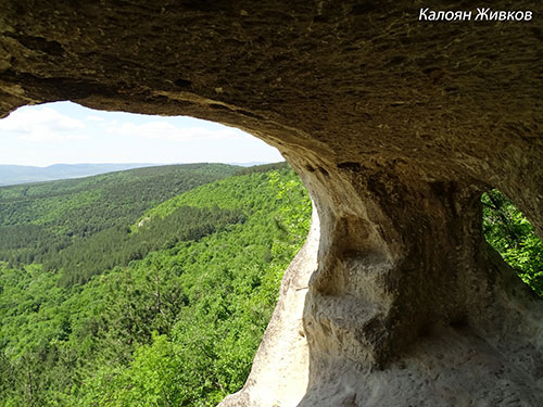
At the bottom of the Troishki Boaz is a lonely rock, which is named "Momina rock". With height of 15 meters and on it on a different heights are clearly visible openings of monastic cells and church. At the top of the flat peak there was a building made by flat stones are connected with mortar.
"Monostirya" is situated, to the left of the Troishka River, carved in the middle of a cave, opposite "Bukatsite" chalet. The rock monastery has two main compartments, one of the premises is unique, because it has been divided on a two floors. Monastic life is reflected in rock charts and images, a carved inscription dating back to the 13th century was found near the entrance of the monastery.
OSMARSKI BOAZ
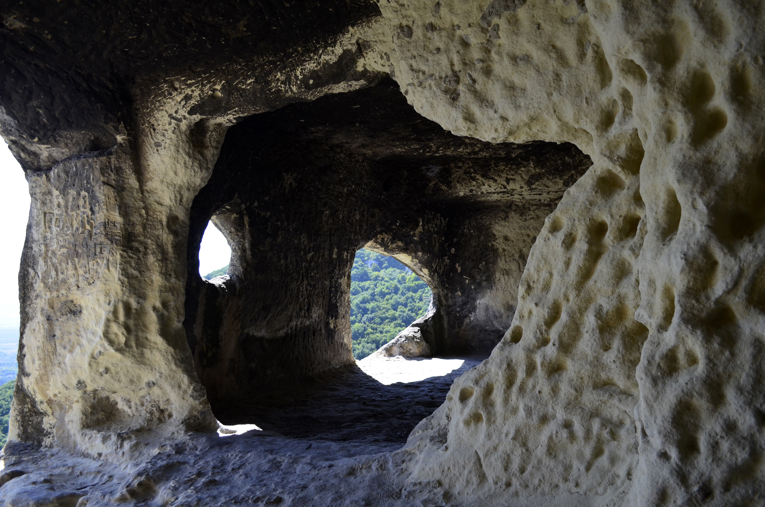
Kostadinov Rock Monastery - probably named after Constantine Tih, who ruled during the Second Bulgarian Kingdom when Veliki Preslav was an important spiritual center. In the altar part there was an iconography with a saint with a white beard and a halo, now a small part of it is preserved. At the top of the Kostadinov Rock Monastery is the rock formation "The eye", it has an ellipsoidal shape similar to the outline of an eye. There are clearly visible holes where there were wooden beams, with metal discs, who knocked on and sounded like bells. It was used as a bell tower.
"The Dry cave" is located to the south of the Kostadinov monastery, about 150m away, there are dozens of stylized rock paintings of people and wild animals. Called the "Dry Cave" because it is really extremely dry and in the last developmental age.
"Direcliyata" is about 100 meters away east of the Kostadinov Monastery. It is called on that way, because a stone pillar is visible from below. The monastery is carved at a height of about 10 meters from the base of the rock, reached with special equipment.
Rock cell "The Podkovata" /horseshoe/ is the other rock settlement located to the southeast of "Directiyata", floor of the cell is with shape of horseshoe , it is 3.5m wide. and has a depth of 3m. From the cell there is a magnificent view of the Osmar valley.
FORTRESS "BOBATA"
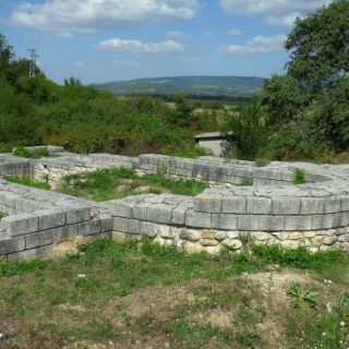
The in-depth observations and analyzes made by the archaeologists Dremsizova and Antonova have found that a fortified Thracian settlement existed in the area of Bobata in the 4th - 3rd centuries BC. According to its plan, fortified walls, etc., the village reminds the Thracian town of Seuthopolis.
Dremmisova, Tsv., V. Antonova. "Contribution to the Oldest History of Shumen and Shumen Plateau", Collection "Shumen - Kolarovgrad", I (1960, p. 7)
The first archaeological research was done by the Czech archaeologist Karel Shkorpil, who also made a sketch of the fortress.
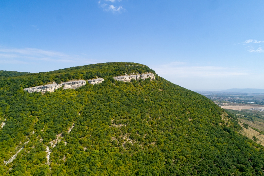
Thracian and antique fortress "Bobata" is situated 0.89 m eastwards in a straight line from the center of the village of Osmar and 2.5 km along the road, at the southern end of the Shumen Plateau. And today, the outlines of collapsed fortress walls from the north and west are clearly visible. The rocks of the East and the South have served as natural defenses for the settlement. There is also a second inner fortification in the shape of a polygon. The outer wall is about 320 m long and the inner wall is 190 m. The distance between the outer and inner fortress walls is on average about 70 m. The walls are made of brick and mud. In the inner fortress there are remnants of stone buildings for the Thracian establishment, in the outside of the dwellings for the rest of the population. The enclosure was in a commercial connection with the Mediterranean Sea, particularly with the island of Thassos. A substantiated proof of this claim is the amphora handle with a stamp from the island. It is assumed that the life of this place lasted until the 11th century.
“MOMINA SKALA”
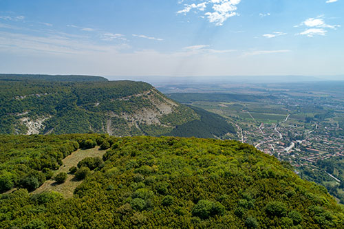
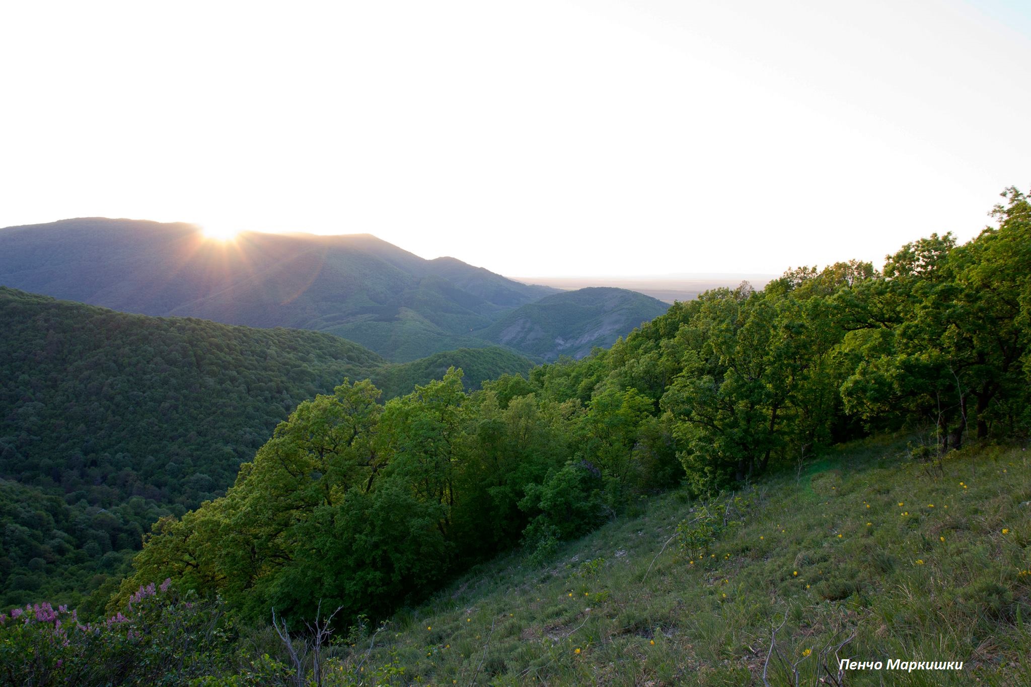
In every legend there is some truth .... The centuries have blurred the mystery of the events that took place in the two major boazes - the Osmar and the Troitsa. "It's up there, where are the inaccessible rocks of the equal behind “Bobata”, a famous Bulgarian boyar lived in the white-stone stronghold, preserved by the steep rocks and the high walls with towers and gates" - telling Troitsans. From here you can see the old capital Pliska, the Madara Rocks, the medieval capital town of Preslav, and centuries-old forests, dotted with meadows and cut by rivers. The Bolyar had a beautiful daughter - Paraskeva.
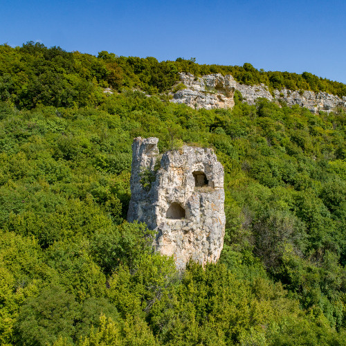
When the Ottomans turned their hordes to Shumen and surrounded the settlements and the solid, she ran through the forest along the steep slopes and climbed to the tall church with the church across the mountain, for God saving her. She looked southward, seeing the steep rocks known from childhood, and even further down a terrible sight. The black-hair girl could not see how the conquerors ruin, burn, kill, enslave everything around. A grief, boundless grief, gripped the throat of the beautiful Paraskeva. Tears, like the river that sprang under the rock, came from her black eyes, and they reached it all the way. This place today still tears drop by drop, surrounded by gentle bighorn and moss. People called it "Momini sulzi". The Ottomans saw her and wanted to catch her, but the courageous bulgarian girl decided - better to die than to give up her faith. Once again, she looked at all of her native and sweet, took her long as snakes hair, her eyes closed, and dropped into the abyss. Since then, the rock has been named "Momina Skala". 15 meters high, with monastic cells and church sculpted. There was also a building on the top. "Momina Skala" stands proud and unreachable as The Bulgarian woman in the centuries. At the bottom of the Troitsa Boaz. A lot of water has leaked out of the cold clear fountain beneath it, many tears are flowing from “Momini sulzi”, to the present day.
THE AUL OF KHAN OMURTAG
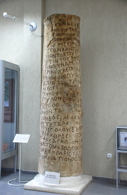
"The great Khan Omurtag is The Prince of God in the land he was born to. Having stayed in the camp of Pliska, he built the Aul [palace] of Tutsa (Tucha) and increased the strength of the Greeks and Slavs. And he artfully built a bridge of Tutsa [Tucha] behind the aul [palace]; but in the fortress he placed four pillars, and between the pillars two copper lions. May God grants the Divine Prince to press with his foot The Emperor while Tutza runs and as long as it holds many Bulgarian opponents and obeys enemies, to experience joy for one hundred years. A time when the [palace or fortress] was built was Bulgarian
sigor elem, and the Greek 15th indict. "
The Chattalarski inscription, opened in 1905 at 500 m northwest of the village of Chatalar
(present-day Khan Krum)
The Aul is situated in the "Hissar Kale" area 2 km south of the village of Khan Krum. According to the inscription of the Chattalar column, it was built in 822 by Khan Omurtag. It is one of the most important Bulgarian military fortifications in the IX-X century, which probably also served as an extra-territorial residence of the Bulgarian ruler (especially in the pagan period). It was built on the model of the capital of the first Bulgarian state Pliska. It consists of an external earth fort (250 decares), a wooden fortification (81, 6 decares) and an inner stone fortress (approximately 10.5 decares), in which barracks, a residential building, a bathroom and a reservoir are revealed.
Relatively better is preserved the western moat and has a width of 4-5 m and a shaft about 1.5-2 m. The wall of the fortress is 1.7 to 1.9 m wide. It is made of cut blocks and mortar. In the second half of 9th century, a basilica church was built in east of the stone fortress. Four more churches have been found within the framework of the earth's fortification, which preceded the creation of the aul. They refer to the Late Roman period and are related to the Goths who settled in the present Bulgarian lands in the IV-V century. Studies show that this is a Gothic Aryan Bishop's Center. A large episcopal church was found under the mound. Near the mound there is another Gothic church dating back to IV century. According to archaeologists, the earliest Christian frescoes on the Bulgarian lands have been placed there. It is believed that this church was personal and, probably to the Bishop of Goths, Wulfilla, who created the ancient Germanic alphabet and translated the Gothic Bible. The Goths are the first federations (the population of the Roman provinces) who accepted Christianity. They are the only non-Romans who in the Roman Empire and Byzantium were administratively autonomous and were allowed to confess their beliefs after the Church Council in Constantinople in 382-383 condemned and forbidden Arianism under Emperor Theodosius.
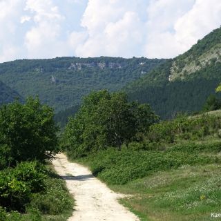
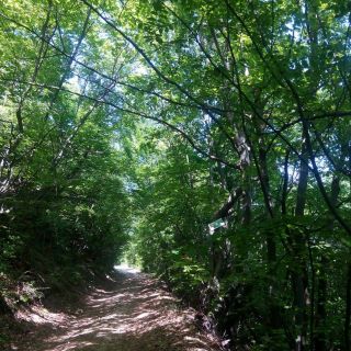
„THE SHORTEST WAY THROUGH THE BALKANS”
"Just listen! Do you know what is telling in a song... We think this people has a lag culture! Because they do not have the palaces of Versailles and the minuets of the Parisian salons! Who gives us the right to say that they are underdeveloped? No! [...] Listen what lightness [...] Just magic. "
Jean-Claude Flasha
Dragoevo village, 1755
On the territory of the village of Dragoevo are found finds from several archaeological eras - prehistoric, Thracian-Roman and Christian. Important transport routes passed through its territory. There are a remains of a Roman road, used and during the Middle Ages. On the firsts of our researchers make an impression a lot of coins from Philip II, Alexander the Great and Lysimach. Because of this, they believe that Alexander passage through this teritories on march against to the Thracians. Probably the village of Dragoevo has originated as a passage village, located on the so-called. Constantinople Road (Stamboliyolu).The entrance of the pass was the locality Parnaritsa, from there through Straja, Tupan, Chervena lokva, descending to the valley of Rish.
One of the legends of the name of the village tells:According to the legend, grandfather Dragoy and his sons feeding their flock here . One day robbers attack the royal's treasury, and the old man, with his shepherds and relatives, helped and saved the treasury from robbery. The Sultan was very pleased from the act of grandfather Dragoy. He invited him to Constantinople to reward him and left him to choose his reward. He wanted to be allowed to settle in this place and the village to take his name, the Ottomans not to live in it and village to be release from taxes. The Sultan allowed him , and for a long time the village residents paid no taxes, but served as the guards of the royal treasury.
Many travelers, scientists, military from different countries and peoples have passed on the "kaldarmata" through the thick forests of the Dragoevski Balkan. Here are some of them: In 1697, Hungarian traveler Janos Komaromi notes that the Bulgarian village of Dragoykioy is situated at the foot of Mountain Novak and is famous with his wine. The village is also mentioned in the notes of travel and diaries of: Captain Shad (1740), Jean-Claude Flasha (1755), Rugger Josip Boskovic (1762), Nibur (1767) Count d'Otriv (1785), Colonel Len (1793), Lieutenant Commander (1827), Captain of the British Navy Charles Colville Franklland (1827), Major Keple (1829) and others.
An ancient land, a land full of legends. Here every place is a story, every stone - fate. Beyond the Panushki spring is the "Kalenik" fountain. There is an old belief in Dragoevo that whoever once drinks "kalenishka" water, can not forget Dragoevo. Among the local population there is a legend that in the locality "Gradishte" in antiquity constantly burning fire. Perhaps it is a sanctuary, found two gold rings, on the tiles of which are depicted temples, confirm this conclusion.